Back

Next Post
Related Posts
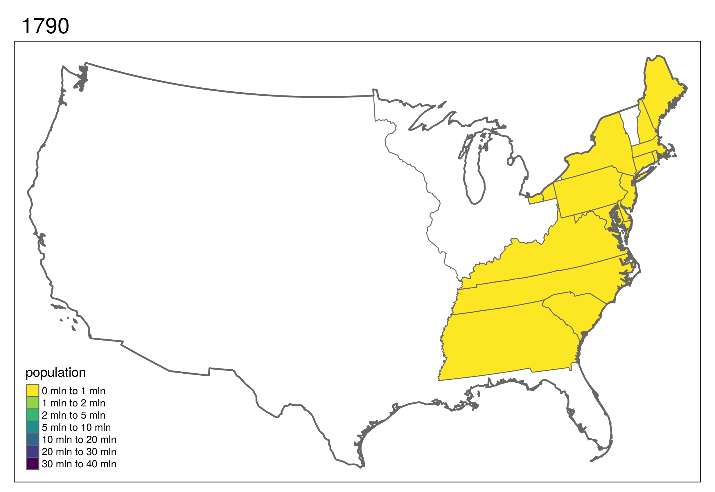
R has increasing functionality for analyzing spatial data, but so has GRASS GIS, QGIS and/or SAGA GIS. This course explains how to use GIS software from within R for statistical geocomputing.
Read More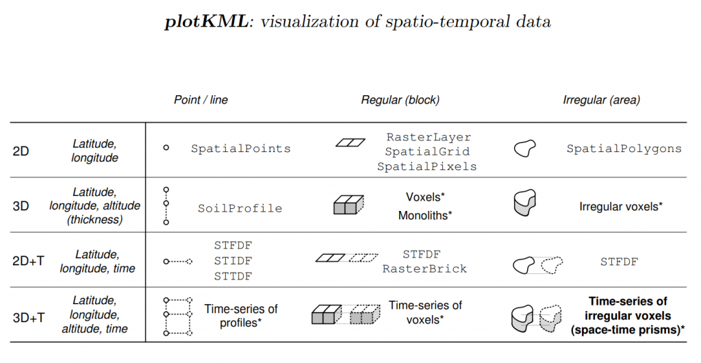
Several R packages exists that allows loading spatial and spatiotemporal data and which provide structures, validity control and functions. One of the packages with the highest number of dependencies is the sp package.
Read More