
Several R packages exists that allows loading spatial and spatiotemporal data and which provide structures, validity control and functions. One of the packages with the highest number of dependencies is the sp package. Vector data is increasingly managed using the sf package, and raster data can be imported using the raster and rgdal packages.
This block course collects number of lectures and examples on what are the most used and most recommended Spatial Classes in R, how to organize spatial data. All lessons are based on the three standard books:
- Bivand, R. S., Pebesma, E. J., Gomez-Rubio, V., & Pebesma, E. J. (2013). Applied spatial data analysis with R (Vol. 747248717). New York: Springer.
- Lovelace, R., Nowosad, J., & Muenchow, J. (2018). Geocomputation with R. https://geocompr.robinlovelace.net/
- Hijmans, R. J., & van Etten, J. (2014). raster: Geographic data analysis and modeling. R package, https://cran.r-project.org/package=raster
Some additional examples can be followed from:
COURSE FEATURES
30 hours of self-study
6 case studies
Real world examples from various packages
Gallery of plots
LESSONS
- sf: Simple Features for R
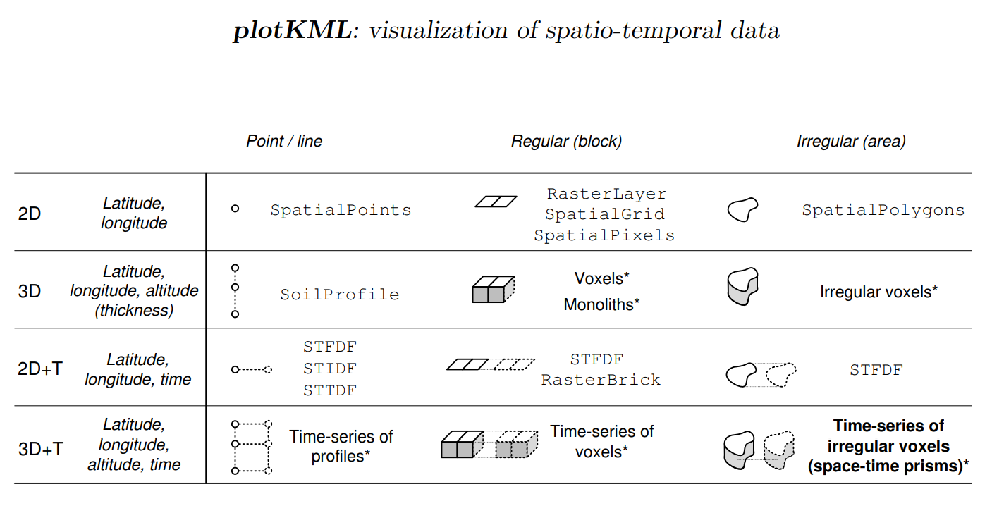
- New R packages for spatial and spatiotemporal vector and raster data
- Simple features for R / tidy spatial analysis
- A practical history of R-sig-geo
sf: Simple Features for R
sf: Simple Features for R by Edzer Pebesma
Simple Features for R i.e. the sf package is the new package to read, manage and process spatial vectors in R. This lecture was taken during the ISRIC Spring School in May 2017.
New R packages for spatial and spatiotemporal vector and raster data
Simple features for R / tidy spatial analysis
Slides available at: https://edzer.github.io/UseR2017/geostat2018.html